
-
Sale!
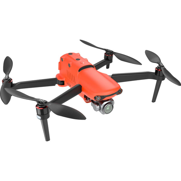
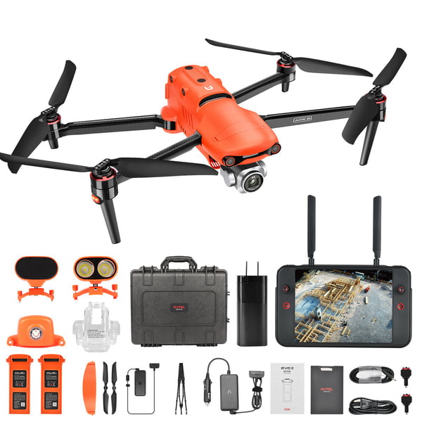
 The Autel EVO II Pro-6K RTK Rugged Bundle V3 delivers professional-grade aerial imaging and precise positioning in one complete kit. Featuring a 20 MP 6K camera, RTK module, extended flight time, 360° obstacle avoidance, and a rugged case, it’s built for surveying, mapping, and high-quality cinematic results.
 -
The EVO II Pro RTK provides a proven, accurate, durable, and user-friendly, FAA Remote ID Compliant Unmanned Aircraft System (UAS) for numerous applications, including the creation of surfaces, point clouds, and orthoimages with Carlson PhotoCapture, as well as feature extraction and CAD plans with Carlson Point Cloud. This package includes PhotoCapture Standalone for Desktop and Carlson Point Cloud to take your aerial data to finished deliverables, the EVO II Pro offers up to 36 minutes of flight time, high accuracy positioning with its detachable RTK module, a 20MP camera with 1″ sensor, and built-in mission planning for simple setup in the field.
-

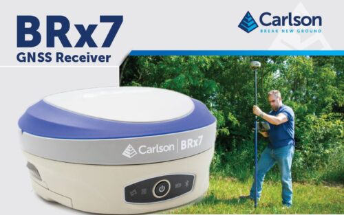
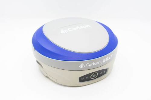
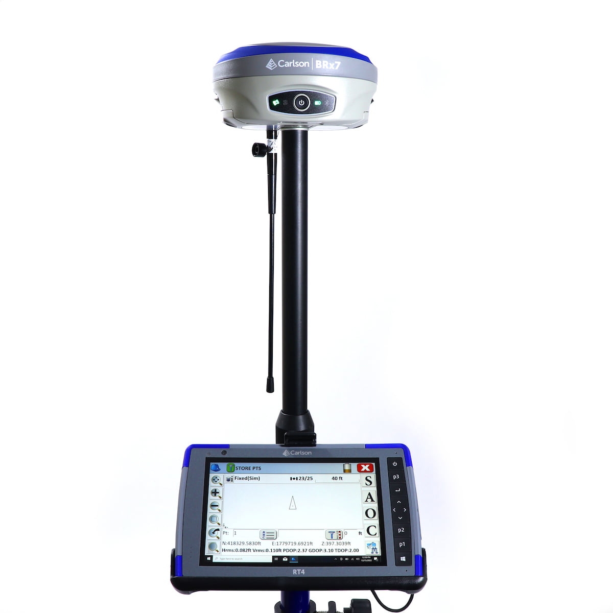
 The BRx7 is Carlson’s all-new multi-GNSS, multifrequency smart antenna. The BRx7 provides robust performance and high precision in a compact, rugged package with tilt compensation ability. With multiple wireless communication ports and an open GNSS interface, the BRx7 can be used in a variety of operating modes.
 -
 This Carlson BRx7 Rover Demo Equipment Package includes two Carlson BRx7 GNSS Receivers, the Carlson RT4 Tablet Data Collector, SurvPC GPS software, a survey pole, an attachment for the tablet to the pole, and all other accessories.
- The BRx7 rover is Carlson’s all-new multi-GNSS, multifrequency smart antenna. The BRx7 provides robust performance and high precision in a compact, rugged package with tilt compensation ability. With multiple wireless communication ports and an open GNSS interface, the BRx7 can be used in a variety of operating modes.
- The Carlson RT4 Tablet is designed for surveying, stake out, construction layout and GIS mapping and is bundled with Carlson SurvPC GPS with the option of running with the Esri® OEM program for use in the field. Or use in the office with any Carlson office software. Along with the 8GB of RAM and 128GB of storage, you can collect and analyze your data quicker than ever before.
- SurvPC supports the widest range of popular and new release RTK GPS and conventional/robotic total stations. Carlson SurvCE and SurvPC are complete data collections systems for Real Time Kinematic (RTK) GNSS and Total Stations with in-field coordinate geometry. SurvPC can be utilized on standard Windows PC computers such as ruggedized laptops.
-

 The Carlson CRD1 is a versatile, advanced and American made sUAS platform with a LiDAR, photogrammetry, bathymetry, or other payload up to 20lbs. The CRD1 is specifically designed for advanced users in the surveying, construction, engineering, mining, quarry, land development, and related industries.
The acquired data – LiDAR, photogrammetry, and bathymetric – can be processed in Carlson PhotoCapture (photogrammetry) and Carlson Point Cloud Advanced (point clouds) to create maps, surface models, design and as-built models, volume calculations, profiles/sections, and more. The CRD1 platform can be fully NDAA-compliant with an optional controller.
It comes with:- CRD1 Aircraft Ready to Fly
- Radio controller
- SKB Travel Case With Custom Foam
- Prop Protectors
- ISO Mount Plate
- Dual battery charger
- Two 16Ah LiPo batteries with case
- GNSS antenna, battery cables, repair toolkit
-
 This pricing is for the CRx2. Give us a call for other version availability and pricing. Comes with:
- p/n: 8040.044.002 1 ZRT82 LRBT Radio Handle
- p/n: 8040.058.010 1 ZBA400, Li-Ion Battery 4.4Ah, rechargeable
- p/n: 8040.060.005 1 ZCH201 Charger for ZBA200 & ZBA400
- p/n: 8040.054.087 1 ZTR101 Tribrach without optical plummet
- p/n: 8040.064.001 1 ZDC301 USB Cable
-
This pricing is for the CRx5. Give us a call for other version availability and pricing. Comes with:
- p/n: 8040.044.002 1 ZRT82 LRBT Radio Handle
- p/n: 8040.058.010 1 ZBA400, Li-Ion Battery 4.4Ah, rechargeable
- p/n: 8040.060.005 1 ZCH201 Charger for ZBA200 & ZBA400
- p/n: 8040.054.087 1 ZTR101 Tribrach without optical plummet
- p/n: 8040.064.001 1 ZDC301 USB Cable
-

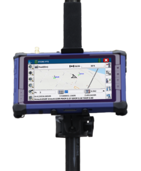
 The Carlson RT4 tablet is designed for surveying, stakeout, construction layout, and GIS mapping. It is bundled with Carlson SurvPC – the Windows-based data collection program. SurvPC includes the option of running the Esri OEM program for GIS field work. The RT4 can also be used in the office with any Carlson office software. With 8GB of RAM and 128 GB of storage, you’ll have the power to collect and analyze your data faster and more efficiently than ever before.
 -
 The Carlson RT4+ is designed for surveying, stakeout, construction layout, and GIS mapping and is bundled with Carlson SurvPC – the Windows-based data collection program. The RT4+ can also be used in the office with any Carlson office software. With Windows 11, 16GB of RAM and 256 GB of storage, you’ll have the power to collect and analyze your data faster and more efficiently than ever before. See More Product Info
 -
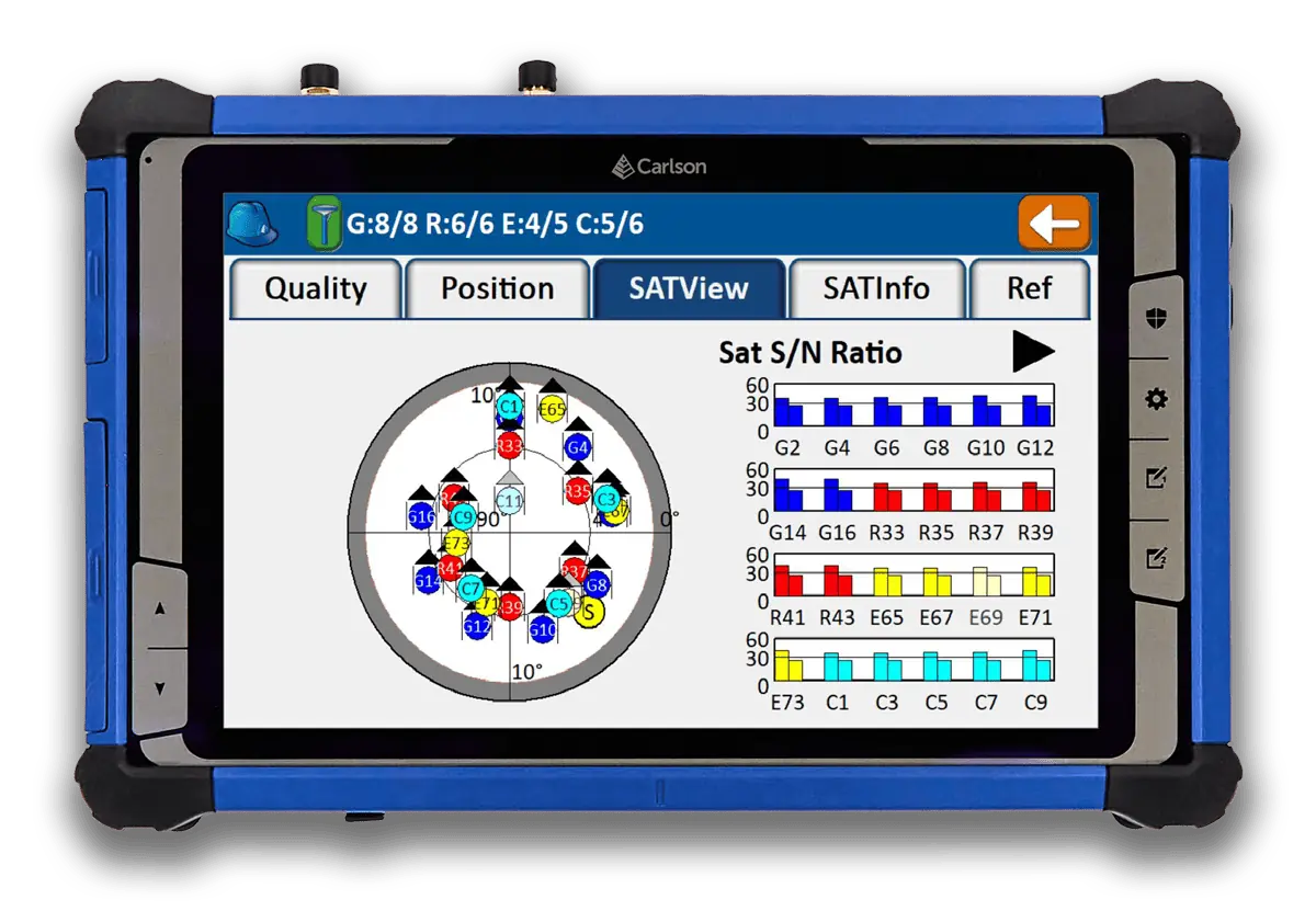
 The Carlson RT5 is a ruggedized Windows data collector designed for surveying, stake-out, construction layout and GIS mapping, and is bundled with Carlson SurvPC – the Windows based data collection program. Optionally, the RT5 can run SurvPC with esri OEM for use in the field. With 8GB of RAM, 256 GB of storage, you can collect and analyze your data quicker than ever before. See More Product Info
 -
 Introducing the Carlson RTk5: Empowering Precision and Flexibility in GNSS Technology Experience unparalleled freedom and precision with the Carlson RTk5, a cutting-edge GNSS solution seamlessly integrated into the RT5. Packed into a compact, lightweight, and versatile package, this advanced device revolutionizes your surveying, engineering, GIS, and GNSS positioning needs. The Carlson RTk5 comes equipped with a range of essential features and accessories designed to enhance your productivity. Its custom-built pole and cradle provide stability and convenience, ensuring seamless operation in any environment. With the inclusion of a survey-grade antenna, you can achieve superior accuracy for your land surveying projects. For on-the-go applications, we have included a small, portable helix antenna specifically tailored for handheld GNSS use. This empowers field professionals with the flexibility to capture precise positioning data on the move. GNSS CAPABILITIES • Advanced multi-frequency, multi-constellation (GPS + GLONASS + Galileo + BeiDou + QZSS) RTK GNSS performance • Balanced & ergonomic; 25+% lighter than typical GNSS setups – 6 lbs (2.7 kg) with tablet, cradle, pole, and antenna • Gather live, centimeter-level positions directly into an Esri database with zero post processing • Operate handheld without a pole for fast GIS work


Who We Are
Allenbuild Instruments LLC
Address: Turning Point Drive, Wake Forest, NC 27587, USA
Tel: +1 (919) 761-5140
Email: Click here to email us
Quick Links

© Copyright 2025 | Allenbuild Instruments | All Rights Reserved | Designed by Sally Compton