
-
 SurvPC supports the widest range of popular and newly released RTK GPS and conventional and robotic total stations, putting the power of Carlson’s in-field coordinate geometry at your fingertips. Note that this requires SurvPC Basic (TS). New features of SurvPC 7 include:
- SurvNet least squares adjustment in the field
- BIM Support for viewing and 2D/3D staking (IFC and RVT)
- Esri ArcGIS Online integration
- Enhanced graphical averaging with full data visibility
- Customizable report generation with field email option
- Catenary survey for robotic total station
- Auto refreshing reference drawings
- Total station monitoring
- Advances in road staking to support BIM and DTM models with real time sectioning
- Fully customizable user hot list
-
SurvPC supports the widest range of popular and newly released RTK GPS and conventional and robotic total stations, putting the power of Carlson’s in-field coordinate geometry at your fingertips. Note that this requires SurvPC Basic (TS). New features of SurvPC 7 include:
- SurvNet least squares adjustment in the field
- BIM Support for viewing and 2D/3D staking (IFC and RVT)
- Esri ArcGIS Online integration
- Enhanced graphical averaging with full data visibility
- Customizable report generation with field email option
- Catenary survey for robotic total station
- Auto refreshing reference drawings
- Total station monitoring
- Advances in road staking to support BIM and DTM models with real time sectioning
- Fully customizable user hot list
-

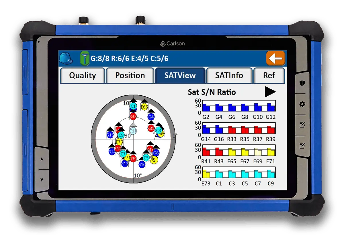
 Introducing the Carlson RTk5: Empowering Precision and Flexibility in GNSS Technology Experience unparalleled freedom and precision with the Carlson RTk5, a cutting-edge GNSS solution seamlessly integrated into the RT5. Packed into a compact, lightweight, and versatile package, this advanced device revolutionizes your surveying, engineering, GIS, and GNSS positioning needs. The Carlson RTk5 comes equipped with a range of essential features and accessories designed to enhance your productivity. Its custom-built pole and cradle provide stability and convenience, ensuring seamless operation in any environment. With the inclusion of a survey-grade antenna, you can achieve superior accuracy for your land surveying projects. For on-the-go applications, we have included a small, portable helix antenna specifically tailored for handheld GNSS use. This empowers field professionals with the flexibility to capture precise positioning data on the move. GNSS CAPABILITIES • Advanced multi-frequency, multi-constellation (GPS + GLONASS + Galileo + BeiDou + QZSS) RTK GNSS performance • Balanced & ergonomic; 25+% lighter than typical GNSS setups – 6 lbs (2.7 kg) with tablet, cradle, pole, and antenna • Gather live, centimeter-level positions directly into an Esri database with zero post processing • Operate handheld without a pole for fast GIS work
 -

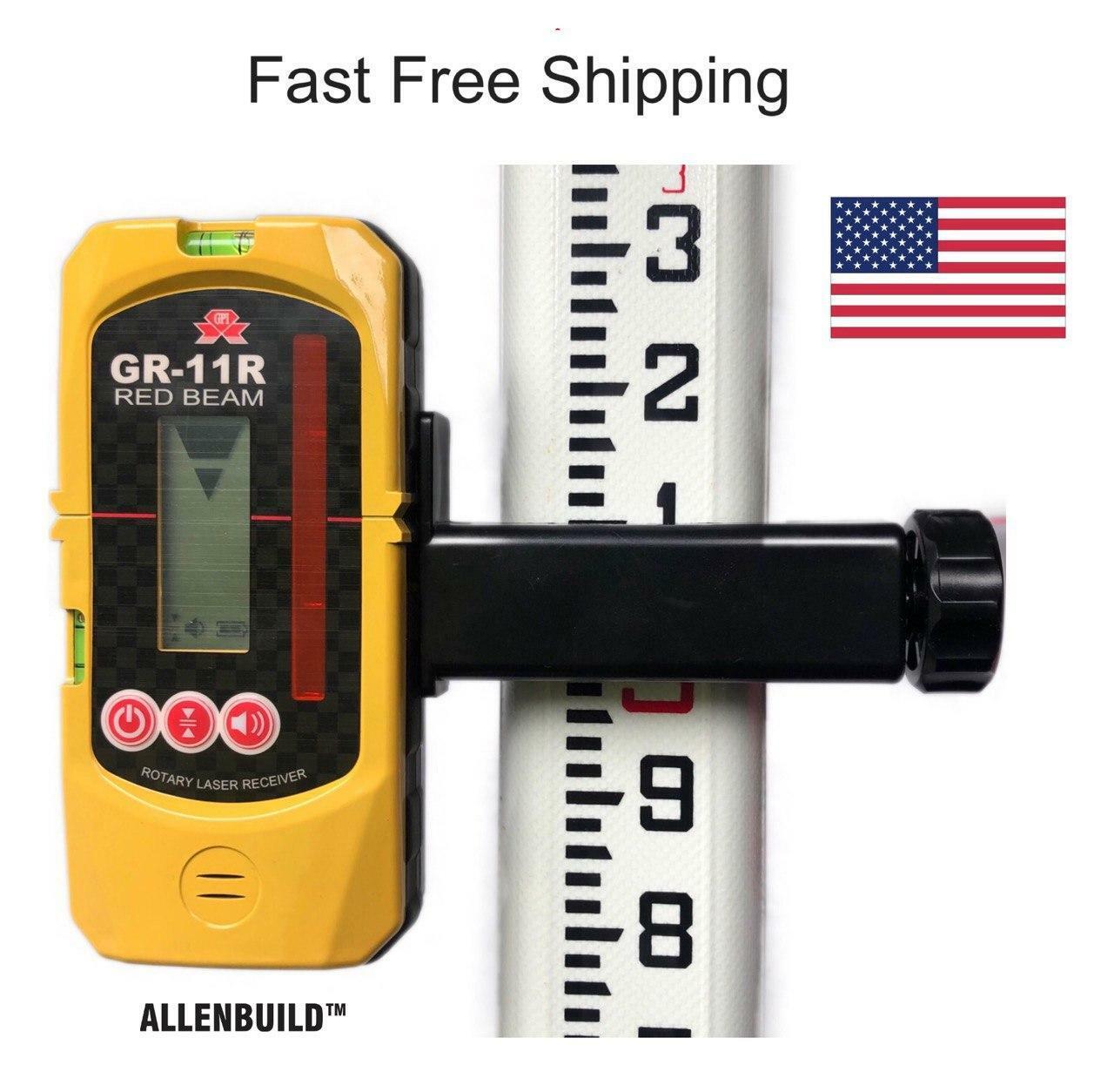
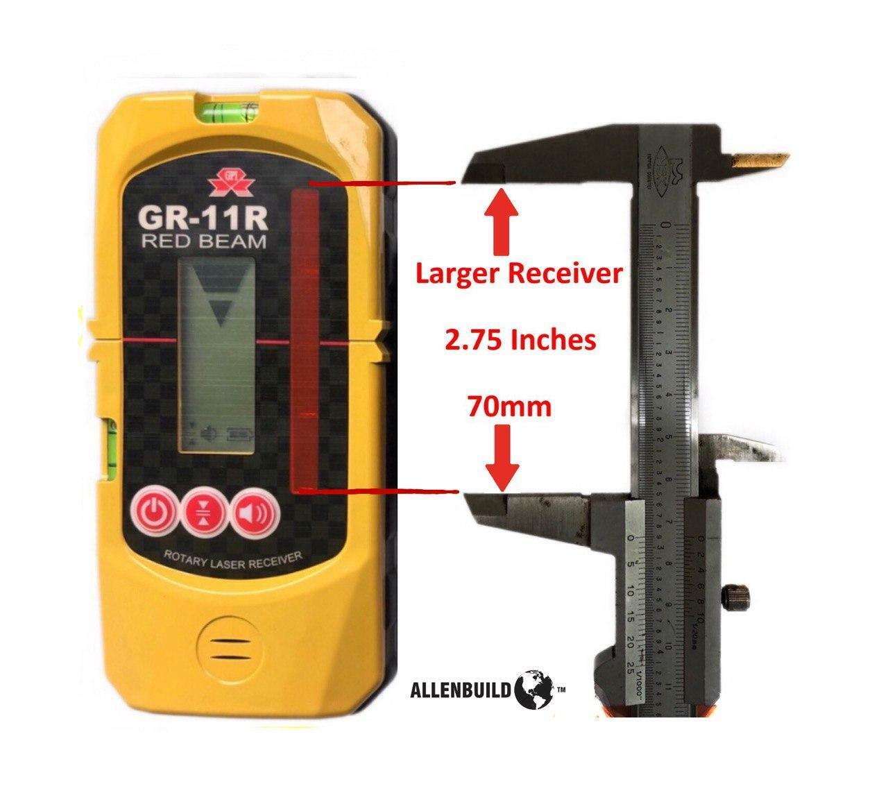
 Free Shipping The Allenbuild Red Laser receiver AB11R is an all-purpose, universal rotary laser receiver with a protective rubber bumper. It is used for detecting the red laser beams in indoor or outdoor conditions where it cannot be seen by the naked eye, such as large construction sites, or for home DIY use. It comes with a rugged bracket, which opens to fit most aluminum and fiberglass staffs and rods up to 65mm/2.1inch wide. The bracket is removable, and the unit can be used to mark out reference points on walls with a pencil in the grooves provided. It operates on two standard AA penlight batteries, and it automatically switches off to save power when not in use.Note: This receiver has bigger range than general small receivers, this laser receiving window range is 70mm (2 3/4 inches) up and down, compared to +- 40mm/1.5inch on other smaller receivers.Very easy to use, complete with leveling rod bracket and 2 bubbles built into receiver, to level it. Fine and rough settings.The device fits all standard leveling rods and is compatible with all laser brands including Topcon, PLS, Spectra, Bosch, Johnson, Acculine, Hilti, CST/Berger, Leica, and Dewalt.Watch a YouTube demo: https://youtu.be/BwiIAnw8H3s
 -
 This pricing is for the CRx2. Give us a call for other version availability and pricing. Comes with:
- p/n: 8040.044.002 1 ZRT82 LRBT Radio Handle
- p/n: 8040.058.010 1 ZBA400, Li-Ion Battery 4.4Ah, rechargeable
- p/n: 8040.060.005 1 ZCH201 Charger for ZBA200 & ZBA400
- p/n: 8040.054.087 1 ZTR101 Tribrach without optical plummet
- p/n: 8040.064.001 1 ZDC301 USB Cable
-

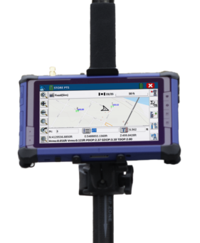
 The Carlson RT4 tablet is designed for surveying, stakeout, construction layout, and GIS mapping. It is bundled with Carlson SurvPC – the Windows-based data collection program. SurvPC includes the option of running the Esri OEM program for GIS field work. The RT4 can also be used in the office with any Carlson office software. With 8GB of RAM and 128 GB of storage, you’ll have the power to collect and analyze your data faster and more efficiently than ever before.
 -

 The Carlson RT4+ is designed for surveying, stakeout, construction layout, and GIS mapping and is bundled with Carlson SurvPC – the Windows-based data collection program. The RT4+ can also be used in the office with any Carlson office software. With Windows 11, 16GB of RAM and 256 GB of storage, you’ll have the power to collect and analyze your data faster and more efficiently than ever before. See More Product Info
 -
The Carlson RT5 is a ruggedized Windows data collector designed for surveying, stake-out, construction layout and GIS mapping, and is bundled with Carlson SurvPC – the Windows based data collection program. Optionally, the RT5 can run SurvPC with esri OEM for use in the field. With 8GB of RAM, 256 GB of storage, you can collect and analyze your data quicker than ever before. See More Product Info
-

 The Carlson CRD1 is a versatile, advanced and American made sUAS platform with a LiDAR, photogrammetry, bathymetry, or other payload up to 20lbs. The CRD1 is specifically designed for advanced users in the surveying, construction, engineering, mining, quarry, land development, and related industries.
The acquired data – LiDAR, photogrammetry, and bathymetric – can be processed in Carlson PhotoCapture (photogrammetry) and Carlson Point Cloud Advanced (point clouds) to create maps, surface models, design and as-built models, volume calculations, profiles/sections, and more. The CRD1 platform can be fully NDAA-compliant with an optional controller.
It comes with:- CRD1 Aircraft Ready to Fly
- Radio controller
- SKB Travel Case With Custom Foam
- Prop Protectors
- ISO Mount Plate
- Dual battery charger
- Two 16Ah LiPo batteries with case
- GNSS antenna, battery cables, repair toolkit
-


Bring point cloud data to your CAD environment.
A modular program that provides the ability to go from field scan to finished plat, Carlson Point Cloud delivers powerful automation for large data sets. View and process up to 1 billion points all with Carlson ease-of-use.Key Features
Point Cloud is available in Basic or Advanced versions. View the system/hardware requirements for Carlson Point Cloud and our other CAD-based software here. View the Point Cloud info brochure here.- Register scans to local coordinates, filter or decimate the points, and overlay raster images in 3D
- Snap to edges and code descriptions for automated field-to-finish processing of linework and symbols
- Create contours, profiles, sections, and breaklines from within the point cloud
ShopSally Compton2023-02-21T03:43:31+00:00