-
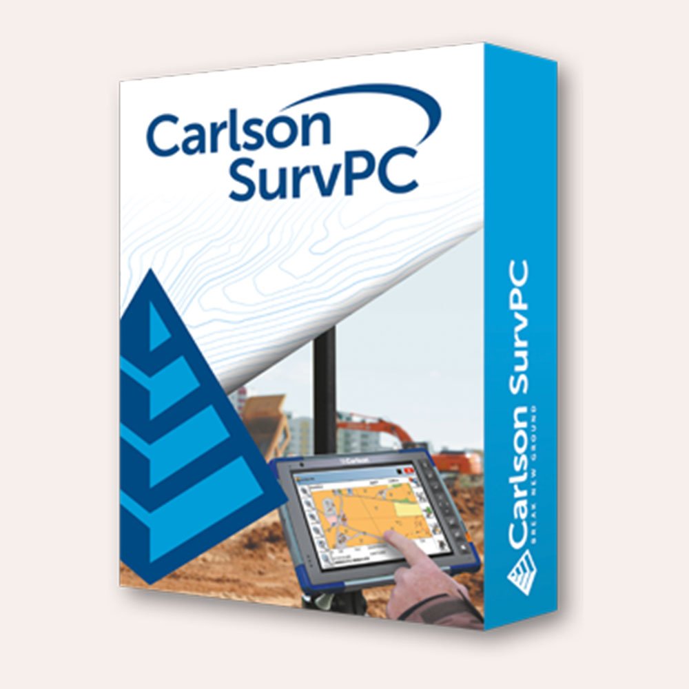
 SurvPC supports the widest range of popular and newly released RTK GPS and conventional and robotic total stations, putting the power of Carlson’s in-field coordinate geometry at your fingertips. Note that this requires SurvPC Basic (TS). New features of SurvPC 7 include:
- SurvNet least squares adjustment in the field
- BIM Support for viewing and 2D/3D staking (IFC and RVT)
- Esri ArcGIS Online integration
- Enhanced graphical averaging with full data visibility
- Customizable report generation with field email option
- Catenary survey for robotic total station
- Auto refreshing reference drawings
- Total station monitoring
- Advances in road staking to support BIM and DTM models with real time sectioning
- Fully customizable user hot list
-
SurvPC supports the widest range of popular and newly released RTK GPS and conventional and robotic total stations, putting the power of Carlson’s in-field coordinate geometry at your fingertips. Note that this requires SurvPC Basic (TS). New features of SurvPC 7 include:
- SurvNet least squares adjustment in the field
- BIM Support for viewing and 2D/3D staking (IFC and RVT)
- Esri ArcGIS Online integration
- Enhanced graphical averaging with full data visibility
- Customizable report generation with field email option
- Catenary survey for robotic total station
- Auto refreshing reference drawings
- Total station monitoring
- Advances in road staking to support BIM and DTM models with real time sectioning
- Fully customizable user hot list
-

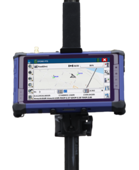
 Introducing the Carlson RTk5: Empowering Precision and Flexibility in GNSS Technology Experience unparalleled freedom and precision with the Carlson RTk5, a cutting-edge GNSS solution seamlessly integrated into the RT5. Packed into a compact, lightweight, and versatile package, this advanced device revolutionizes your surveying, engineering, GIS, and GNSS positioning needs. The Carlson RTk5 comes equipped with a range of essential features and accessories designed to enhance your productivity. Its custom-built pole and cradle provide stability and convenience, ensuring seamless operation in any environment. With the inclusion of a survey-grade antenna, you can achieve superior accuracy for your land surveying projects. For on-the-go applications, we have included a small, portable helix antenna specifically tailored for handheld GNSS use. This empowers field professionals with the flexibility to capture precise positioning data on the move. GNSS CAPABILITIES • Advanced multi-frequency, multi-constellation (GPS + GLONASS + Galileo + BeiDou + QZSS) RTK GNSS performance • Balanced & ergonomic; 25+% lighter than typical GNSS setups – 6 lbs (2.7 kg) with tablet, cradle, pole, and antenna • Gather live, centimeter-level positions directly into an Esri database with zero post processing • Operate handheld without a pole for fast GIS work
 -

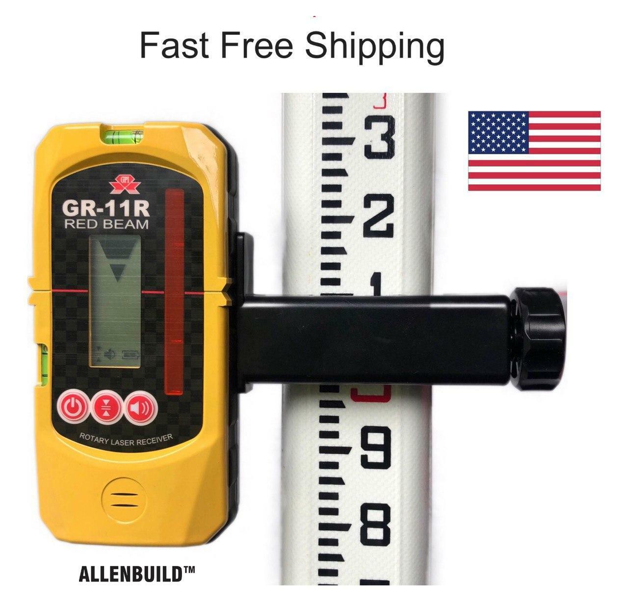
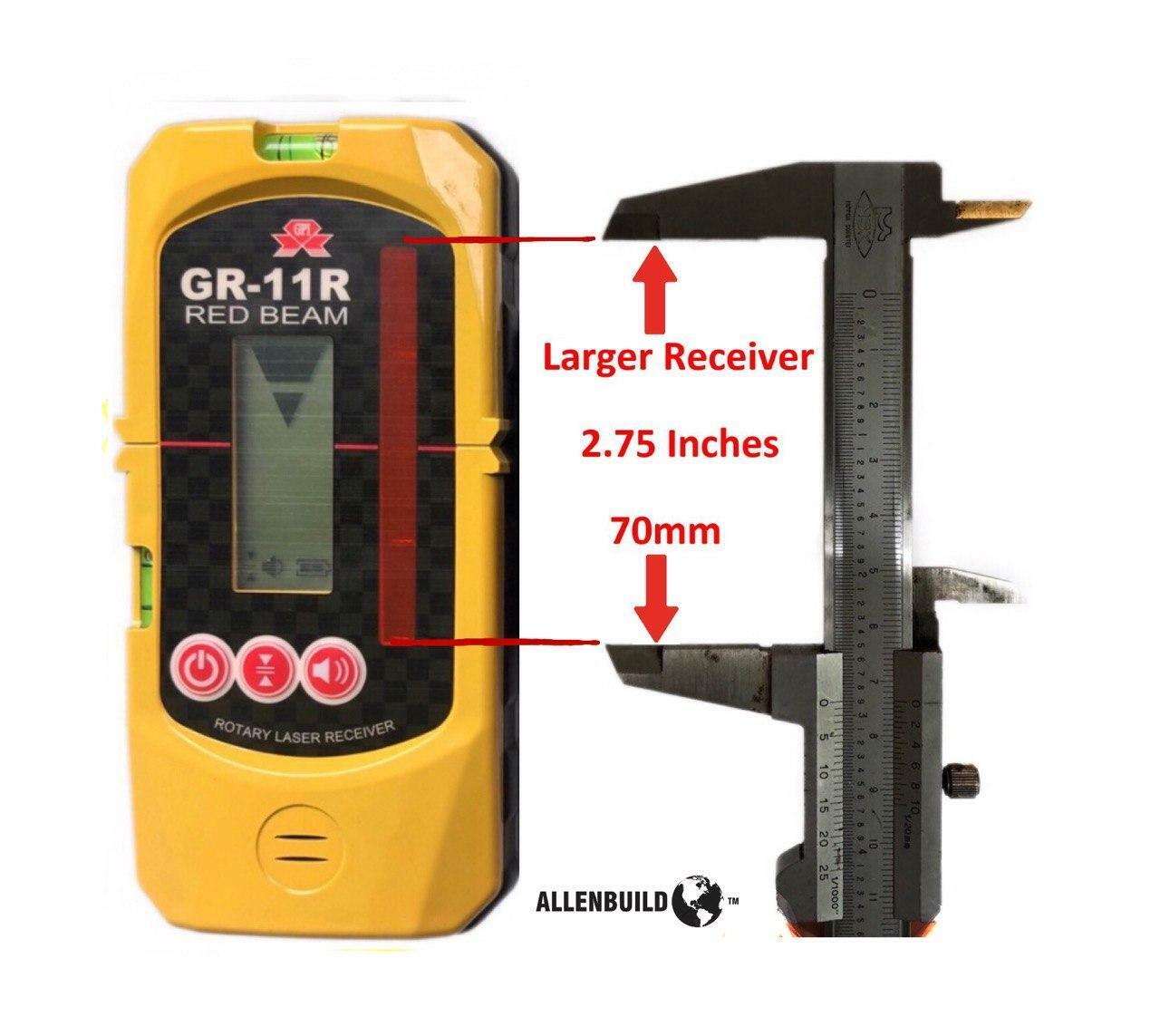
 Free Shipping The Allenbuild Red Laser receiver AB11R is an all-purpose, universal rotary laser receiver with a protective rubber bumper. It is used for detecting the red laser beams in indoor or outdoor conditions where it cannot be seen by the naked eye, such as large construction sites, or for home DIY use. It comes with a rugged bracket, which opens to fit most aluminum and fiberglass staffs and rods up to 65mm/2.1inch wide. The bracket is removable, and the unit can be used to mark out reference points on walls with a pencil in the grooves provided. It operates on two standard AA penlight batteries, and it automatically switches off to save power when not in use.Note: This receiver has bigger range than general small receivers, this laser receiving window range is 70mm (2 3/4 inches) up and down, compared to +- 40mm/1.5inch on other smaller receivers.Very easy to use, complete with leveling rod bracket and 2 bubbles built into receiver, to level it. Fine and rough settings.The device fits all standard leveling rods and is compatible with all laser brands including Topcon, PLS, Spectra, Bosch, Johnson, Acculine, Hilti, CST/Berger, Leica, and Dewalt.Watch a YouTube demo: https://youtu.be/BwiIAnw8H3s
 -

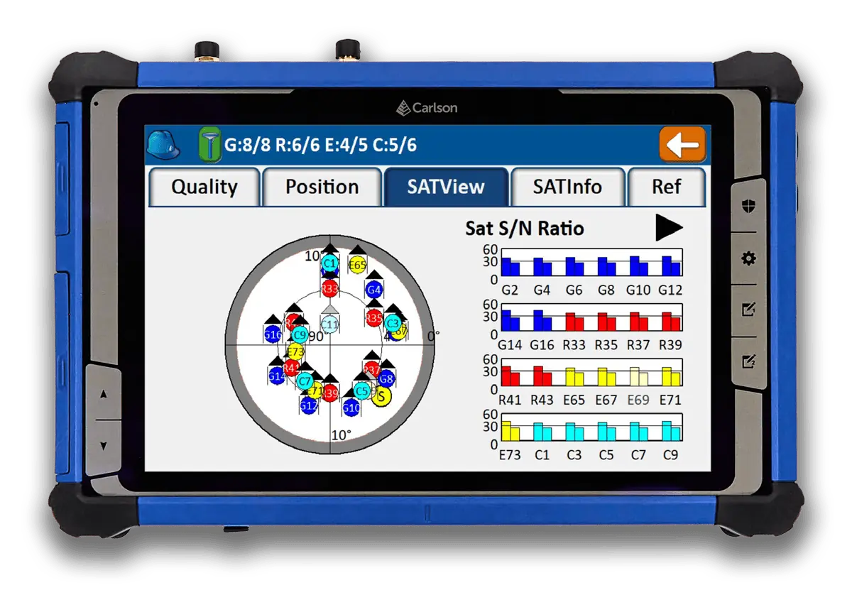
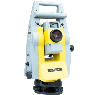
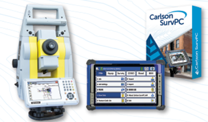
 End of year special: CRx 5" plus RT5 Tablet w/ SurvPC Total Station & RTS The Carlson CRx series of Robotic Total Stations provides a choice of 1″, 2″ and 5″ angular resolutions to match the application requirements. This offer is for the 5". This model is the CRx-5 for a seamless user experience. The instruments are combined with SurvCE or SurvPC on a field computer to access the full range of Carlson survey features for efficiency and automation in a familiar environment. In addition, users have the option for installing SurvCE Basic on board for operation with the instrument only. Customers benefit from technical guidance and support for both the robotic total station and SurvCE or SurvPC from one company. CRx Robotic Total Stations are used with SurvCE or SurvPC in a wide range of applications requiring precise angle and distance measurements such as surveying, engineering and construction.
 -
End of year special: CRx 2" with RT5 Tablet plus SurvPC Total Station & RTS The Carlson CRx series of Robotic Total Stations provides a choice of 1″, 2″ and 5″ angular resolutions to match the application requirements. This offer is for the 2". This model is the CRx-5 for a seamless user experience. The instruments are combined with SurvCE or SurvPC on a field computer to access the full range of Carlson survey features for efficiency and automation in a familiar environment. In addition, users have the option for installing SurvCE Basic on board for operation with the instrument only. Customers benefit from technical guidance and support for both the robotic total station and SurvCE or SurvPC from one company. CRx Robotic Total Stations are used with SurvCE or SurvPC in a wide range of applications requiring precise angle and distance measurements such as surveying, engineering and construction.
ShopSally Compton2023-02-21T03:43:31+00:00